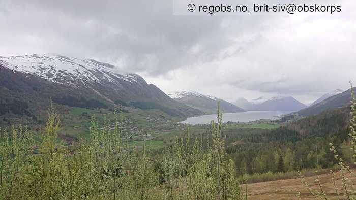
Image 1 of 9 Of: Weather Copyright: brit-siv@obskorps Comment: Lågt skydekke og bygevêr. Mot nordaust
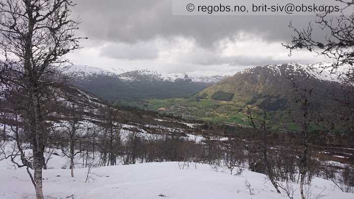
Image 2 of 9 Of: Weather Copyright: brit-siv@obskorps
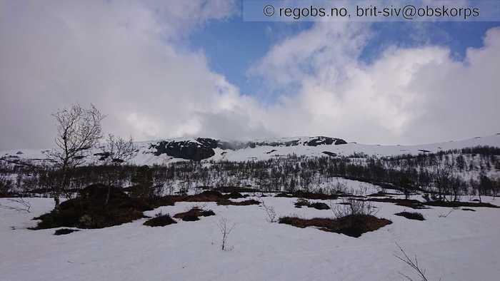
Image 3 of 9 Of: Weather Copyright: brit-siv@obskorps Comment: Periodevis lettare skydekke og nokon glimt av blå himmel

Image 4 of 9 Of: Snow Cover Copyright: brit-siv@obskorps Comment: Delvis snødekke frå ca 500 moh
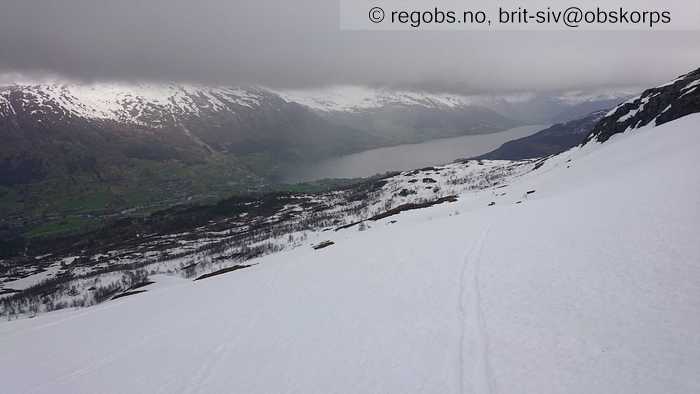
Image 5 of 9 Of: Snow Cover Copyright: brit-siv@obskorps Comment: Bærande vått snødekke, smelteomvandla grovkorna snø
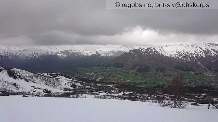
Image 6 of 9 Of: Snow Cover Copyright: brit-siv@obskorps Comment: Høgare snøgrense i bratt solvendt terreng, og ein del bare ryggar
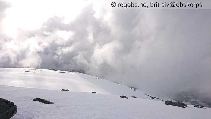
Image 7 of 9 Of: Weather Copyright: brit-siv@obskorps Comment: Skiftande bygevêr
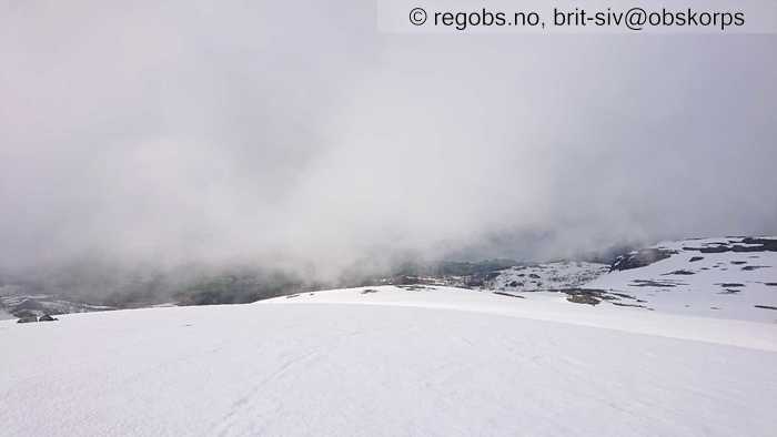
Image 8 of 9 Of: Snow Cover Copyright: brit-siv@obskorps
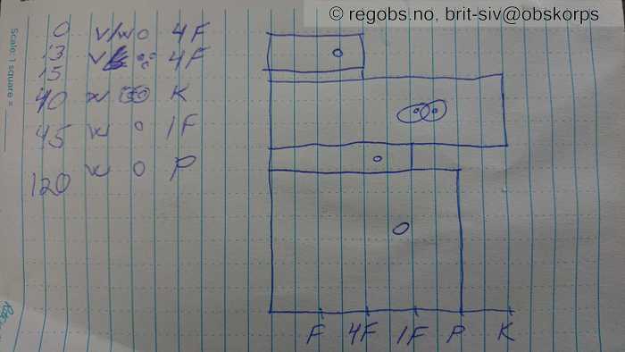
Image 9 of 9 Of: Snow Profile Copyright: brit-siv@obskorps Comment: Ingen brudd
Danger Sign
• Much water in the snow • Område: I dalen/fjorden. Beskrivelse: Frå ca 900 moh, meir vatn i det øverste laget.
Avalanche Activity
• 27. May. During the day • No avalanche activity • Såg ingen heilt ferske skred
Weather
• Rain • 1 °C • 10 m/s from W → • 100% clouds • Bygevêr, for det meste overskya og lågt skydekke. 1 grad på toppen, og 6 grader nede ved bilen på 450 moh. Periodevis oppklarning og glimt av blå himmel og sol. Svak vind frå ca 700 moh, aukande mot toppen. Ei snøbyge nær toppen på 1000 moh, men det har ikkje lagt seg nysnø på denne høgda.
Snow Cover
• 150 cm • No snowdrift • 0 cm • Snow line at 500 masl • Other • Wet • Delvis snødekke frå ca 500 moh i dalane i indre delar av regionen. I bratt solvendt terreng lite eller ingen snø under skoggrensa. Høgare snøgrense i ytre delar. Frå 6-700 moh og oppover mykje snø for årstida i terreng som har samla snø gjennom vinteren. Begynner å bli store bare områder på ryggar og vindutsatte plassar som har vore avblåst gjennom vinteren. Snødekket har satt seg siste dagane, og er bærande. Det er smelteomvandla og vått etter høge temperaturar siste veka, og regn dei siste dagane. Opp til ca 900 moh drenerer vatnet godt. Vidare oppover meir vatn i det øverste laget, oppå gjenfryst grovkorna snødekke.
Snow Profile
• Problem med å registrere snøprofil
Avalanche Problems
• Loose wet avalanche • Loose snow • Spontaneous release • 2 - Medium • Some steep slopes N, NE, E, SE, S, SW, W, NW between 1200 masl and 900 masl • Mykje vatn i øvre del av snødekket frå 900 moh og opp til mildvêrsgrensa. Lett å løyse ut våte laussnøskred i brattheng, og vil også kunne gå nokon naturleg utløyste våte skred.
• Wet slab avalanche • Wet snow/melting near the ground • Spontaneous release • 3 - Large • Few steep slopes N, NE, E, SE, S, SW, W, NW between 1200 masl and 500 masl • Glideskred i bratt terreng der snødekket ligg på sva eller glatt underlag. Typisk der ein ser sigesprekker i snødekket.
Avalanche Danger Assessment
• Det er fortsatt mykje vatn i snødekket som kan føre til små til mellomstore våte laussnøskred i bratt terreng. Mykje vatn i snødekket gir også fare for naturlege utløyste glideskred i bratt terreng. Det er typisk der ein kan sjå sigesprekker i snødekket. Ellers må ein være forsiktig i nærheten av skavlar, som kan knekke og dra med seg snøen under, og gi store skred i underkant av skavlen. • Stigande temperatur og sol vil fortsatt gi ein del våte skred, glideskred og skavlbrudd • 2 Moderate • Forecast correct

